The Data Service Polygon is a great way to target specific areas within a county. Here’s how:
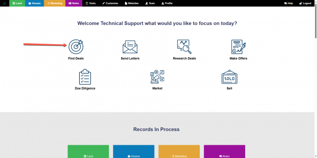
From the Investment Dominator home page select the Find Deals Wizard:
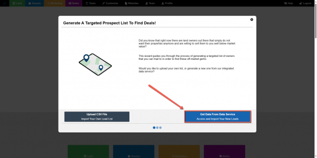
Then, select Get Data From Data Service:
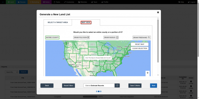
Next, select Map View. This leads to the interactive map:
Choose a state by clicking on a state, then use ctrl + scroll to zoom into the state to view the counties outlined in blue. After selecting your county, continue to scroll in to view neighborhoods. Once you have decided on an area, select Draw Polygon.
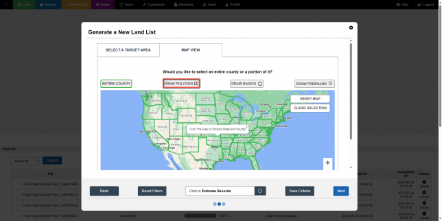
Then, select 3 to 4 points around the area. This action will create a shape around the selection of the county you selected.
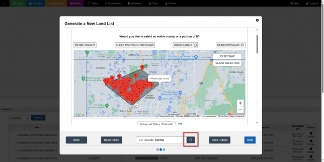
You can adjust the points to cover a greater or smaller area or remove the default filters to access additional leads. Remember to refresh the estimated record amount for the most accurate data. If you decide you do not want to use the area you selected, simply select Clear Polygon Freehand to clear the polygon shape and Reset Map to remove the pins.