The Investment Dominator is integrated with a selling website, and can pull information directly from your property records to prepare attractive online listings.
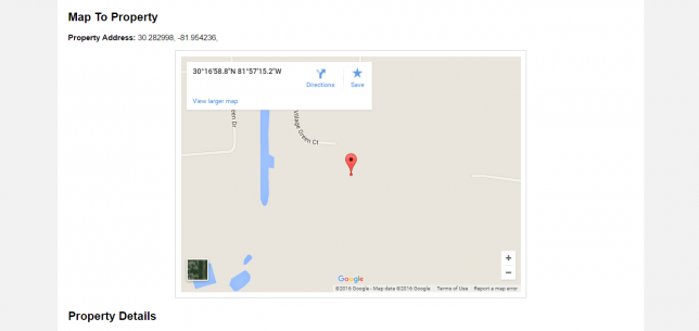
Aside from images and files, you can also let potential buyers see an interactive map in the property listing. They can use this to better visualize the property location and to get directions to it if they wish to visit personally.
To make sure that an interactive map will be displayed in your property listing, you will need to make sure that there is a physical address or latitude/longitude entered into the property record.
Here’s how you can do it.
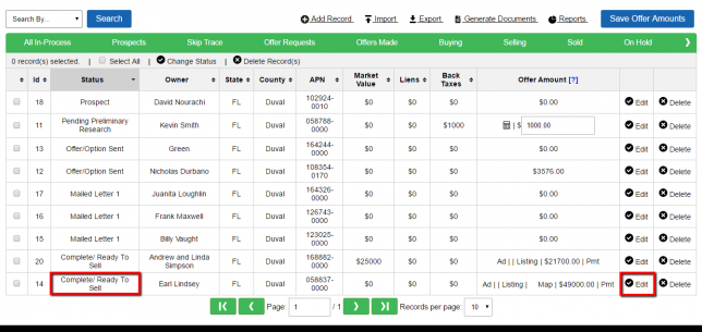
After logging into the Investment Dominator and clicking on “Land Deals”, locate the property whose listing you want to change (remember, the property record must be in the “Complete/Ready to Sell” status.
Then, click “Edit” on the right hand side.
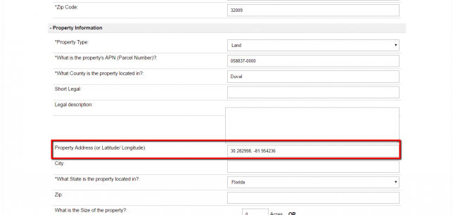
Once inside the property record, scroll down to the “Property Information” section and enter in the property’s physical location (if you have it) or the latitude/ longitude.
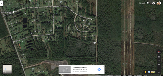
NOTE: In case you don’t have a GPS unit handy, you can get the latitude/ longitude by locating the property on Google Maps and right-clicking on it. Select “What’s here?” and Google will give the the exact coordinates.
After you enter the property’s physical location or the latitude/ longitude, scroll down to the bottom of the page and click “Update Record”.
The system will automatically use the property’s location to create an interactive map in the property listing.